Gefechtsstand Bunker.
The Luftnachrichten Dienst.
Jagdabschnittsführer Führer Ostpreussen, Königsberg-Seewiesen (Löwenhagen), ”DEUTSCHMEISTER.
This facility is on the mystery list. Several written sources have indicated, that a bunker facility was constructed to serve as GefStd for the above HQ. But due to the remoteness of the location it has been hard to obtain any detailed information.
But now the mystery has finally been solved thanks to Mr. Lutz Nolte, who sent me the folowing e-mail on 2011-06-18:
Today I had a conversation with a man, who lived as young boy in Löwenhagen
until 25.Jan 1945. He was 15 years old when his family had to flee.
He confirmed the position as 54°37'45" N 20°46'33" E at bottom of the
hillside of the SCHAAR with an elevation of 4 meter.
The construction work started around 1943 and the bunker was in use for 1
year until January 1945.
It is strange that the Gefstd was not built into the hillside according the
contemporary witness, instead it was built in the flat area in front of it
with all the problems like groundwater etc.
Today the bunker's top is visible and it is impossible to enter it due to
the high level of water, it is flooded.
A friend of him told about of 118 wires connecting the bunker with other HQs and a rumor said the bunker should be connected with a new Führerhauptquartier in Elbing (Elblag).
Ostpreußen.net - Ihr Portal rund um Ostpreußen - Kreise und Orte
.jpg)
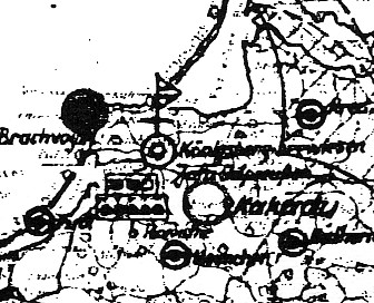
RAF intelligence map depicting Devau just E and Seewiesen SE of the city.
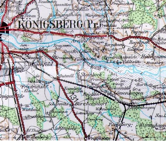
Vintage map of Königsberg-Seewiesen (Löwenhagen). The GefStd of the Jafü could be located in one of the wooded areas around Löwenhagen.
.jpg)
.jpg)
.jpg)
.JPG)
.jpg)
![]()